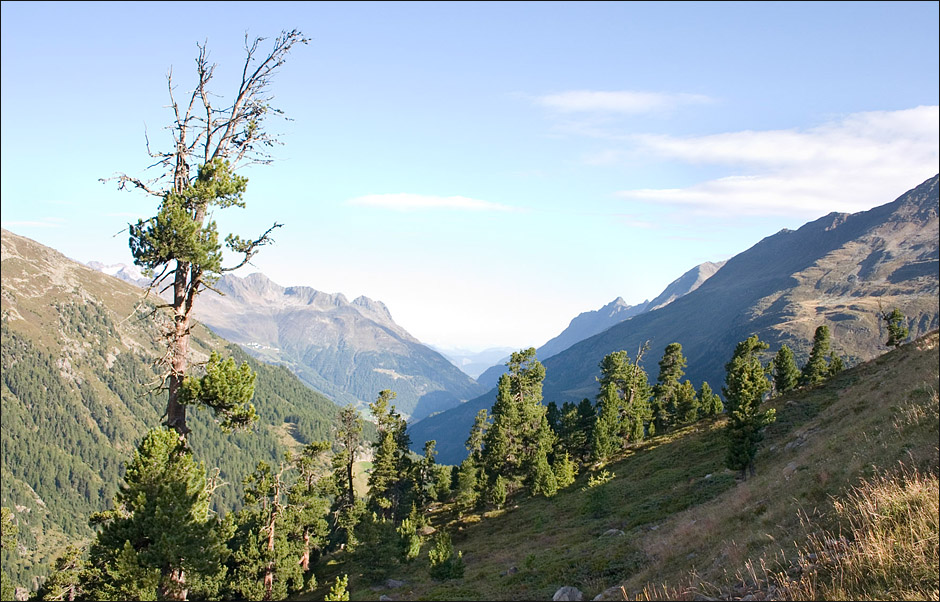
ÄîëèГà ðåêè Otztal, Òèðîëü, Àâñòðèÿ |
×òîáû ïîñìîòðåòü ãîðû, ïîåõà ëè Гў Àâñòðèþ. ГќГІГ® îäГГ ГЁГ§ ñà ìûõ êðà ñèâûõ äîëèГ. ÏðîòÿГóëà ñü ГГ ГѕГЈ äî ãðà Гèöû Г± Èòà ëèåé. Г‚ äîëèГГҐ Г¬Гîãî êóðîðòГûõ ïîñåëêîâ. Г‚ êà æäîì ïîñåëêå ãîñòèГèöû, ïîäüåìГГЁГЄГЁ. Г‚ Ober-Langrnfeld áîëüøîé à êâà ïà ðê, ГЎГ ГГЁ. |
| Автор: | Vladimir Aleksandrov |
| Показано: | 4337 | | Голосов: | 0 |
| Добавлено: | 2007-09-07 | | Средний балл: | 0.00 |
|
|
Комментарии к фотографии
| 1 | Vladimir Aleksandrov
2007-09-07 14:52 | | The Ötztal is a 65-kilometer long alpine valley in the Austrian state of Tyrol. The Ötztaler Ache river flows through the valley in a northern direction. The Ötztal separates the Stubai Alps in the east from the Ötztal Alps in the west. The northern end of the valley is at the confluence of the Ötztaler Ache and Inn rivers, 8 kilometers east of Imst and 50 kilometers west of Innsbruck. The southern end of the valley terminates at the border with Italy, formed by the main chain of the Alps, with many glaciers and high peaks, including the Weißkugel and the Similaun. The village of Obergurgl at the southern end of the Ötztal Gurglertal valley is the highest parish in Austria. In 1991, Ötzi the Iceman, a well-preserved natural mummy from about 3,300 BC, was found in the nearby Schnalstal glacier on the Similaun. The Ötztal valley is comprised of five municipalities (from north to south): Sautens, Ötz, Umhausen, Längenfeld, and Sölden. The main industry in the valley is tourism: the mountains around the Ötztal valley are popular with mountaineers and skiers. There are ski resorts in the upper part of the valley at Sölden, Hochsölden, and Hochgurgl. The Timmelsjoch mountain pass connects the Ötztal valley with the Val Passiria and Merano in South Tyrol, Italy. |
< Предыдущее | Вернуться к альбому | Следующее > |